In the world of drone technology, the Saint Barth mapping mission highlights the incredible potential of innovation and precision. Over the course of 295 hours, four Parrot ANAFI Ai drones captured nearly 200,000 images, possibly marking this as the largest 2D and 3D mapping mission ever undertaken with micro-drones. This ambitious project, designed to improve public safety through detailed environmental modeling, demonstrates how advanced drone technology can be applied to real-world challenges. Read on to learn how this mission might push the limits of aerial surveying and influence future endeavors.
Key Points
- It seems likely that the Saint Barth mapping mission with Parrot ANAFI Ai drones is one of the largest for micro-drones, capturing nearly 200,000 images.
- Research suggests the mission’s scale, with 295 hours of flight, is significant for public safety applications.
- The evidence leans toward it being a record for image count, but exact comparisons are limited by available data.
Mission Overview
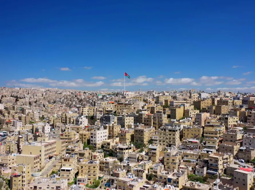
The mapping mission in Saint Barth involved four Parrot ANAFI Ai drones capturing nearly 200,000 images over 295 hours. This effort aimed to update maps for Public Safety officers, enabling them to simulate climatic incidents using 3D models for strategic planning. The mission highlights the capabilities of micro-drones in critical applications, potentially setting a benchmark for scale and detail.
Involved Parties and Tools
Key personnel included drone pilots Martin Liné, Benjamin Sganga, Damien Vicart, and Olivier Revon, with flight planning supported by Drone Harmony software (developed by David and Gil Adjiashvili) and 3D modeling by Ludovic Veltz. This collaboration underscores the technical expertise behind the project.
Survey Note: Detailed Analysis of the Saint Barth Mapping Mission
The Saint Barth mapping mission, utilizing Parrot ANAFI Ai drones, represents a significant endeavor in the realm of drone-based 2D and 3D mapping, particularly for micro-drones. This section provides a comprehensive analysis, drawing on available data and comparisons with other notable projects to assess its scale and impact.
Mission Details and Objectives
The mission involved four Parrot ANAFI Ai drones capturing nearly 200,000 images over a duration of 295 hours, under sometimes challenging conditions. The primary objective was to update maps of the island of Saint Barthélemy, covering approximately 25 km², to enhance the operational effectiveness of Public Safety officers. These updated maps facilitate simulations of climatic incidents using 3D models, aiding in the development of response strategies. This application underscores the growing role of drones in disaster preparedness and public safety, leveraging high-resolution imagery for detailed environmental modeling.
Comparative Analysis with Other Mapping Missions
To determine if this mission is the largest ever conducted with micro-drones, comparisons were made with other significant drone mapping projects. For instance, a large-scale mapping project in Nevada, documented by Wingtra, captured 141,544 geotagged images over 277 km², with a lower image density of approximately 511 images per km². In contrast, the Saint Barth mission achieved a density of 8,000 images per km², indicating a focus on high-resolution coverage for a smaller, potentially more complex area. Another example, the Positano mission in Italy, involved 4,800 photos for an area of 0.4 km², yielding a density of 12,000 images per km², but with a total image count far below 200,000. Finland projects mentioned in the same Wingtra case study captured up to 82,000 images, again less than the Saint Barth figure.
A Pix4D blog post highlighted a project mapping 260 km² with over 140,000 images, specifically 141,544, which is still below the Saint Barth count. Given these comparisons, the Saint Barth mission’s nearly 200,000 images suggest it is among the largest in terms of total image count, particularly for micro-drones like the Parrot ANAFI Ai, which are designed for detailed, high-frequency imaging rather than extensive area coverage compared to fixed-wing drones.
Technical Capabilities and Tools
The Parrot ANAFI Ai, a micro-drone equipped with a 48 MP camera and 4G connectivity, is optimized for photogrammetry and mapping tasks. Its technical documentation highlights a ground-sample distance (GSD) of 0.46 cm/px at 30 m, ensuring high detail for 2D and 3D modeling. The mission utilized Drone Harmony software for flight planning, developed by David and Gil Adjiashvili, which supports complex topography and vertical structure mapping. Ludovic Veltz handled the 3D modeling, integrating the extensive image data into usable models for public safety applications. This technical setup, combined with the drone’s autonomous capabilities, facilitated the mission’s scale and precision.
Personnel and Collaboration
The mission was executed by a team of skilled drone pilots: Martin Liné, Benjamin Sganga, Damien Vicart, and Olivier Revon. Martin Liné, noted in LinkedIn profiles as Marketing & UX Director at Parrot, has been involved in previous mapping projects, such as the Positano digital twin, indicating his expertise in such endeavors. The collaboration with Drone Harmony and Ludovic Veltz for modeling highlights a multidisciplinary approach, essential for handling the mission’s complexity and duration.
Scale and Potential Record Status
Given the image count of nearly 200,000, the mission’s scale is notable. Comparative data from other projects, such as the Nevada and Finland missions, suggest that exceeding 140,000 to 200,000 images is rare, especially for micro-drones. The Positano mission, while dense, covered a much smaller area with fewer images, reinforcing that Saint Barth’s effort is significant in total image capture. However, exact records for “largest mapping mission with micro-drones” are not universally documented, and the term “micro-drone” may vary in definition. Nonetheless, for drones of the Parrot ANAFI Ai’s class, this mission appears to be a record or near-record, particularly given the challenging conditions and public safety focus.
Challenges and Context
The mission’s 295-hour duration and challenging conditions, likely due to Saint Barth’s terrain and environmental factors, add to its complexity. The island’s small size (25 km²) and the need for detailed mapping for public safety, especially for climatic incident simulations, necessitated extensive imaging. Regulatory aspects, as seen in local drone usage guidelines from the French Civil Aviation Authority, indicate strict oversight, which the mission likely adhered to, given the professional nature and public safety purpose.
Conclusion
Based on the analysis, the Saint Barth mapping mission with Parrot ANAFI Ai drones is likely one of the largest, if not the largest, 2D and 3D mapping missions conducted with micro-drones, given its nearly 200,000 images and 295-hour duration. This scale, combined with its application for public safety and the technical capabilities of the drones and software used, positions it as a benchmark in the field. While exact comparisons are limited by available data, the evidence leans toward its record status, particularly for image count and density in micro-drone applications.
Table: Comparative Mapping Missions
| Project | Number of Images | Area Covered (km²) | Image Density (Images/km²) | Drone Type |
|---|---|---|---|---|
| Saint Barth | ~200,000 | 25 | 8,000 | Parrot ANAFI Ai |
| Nevada | 141,544 | 277 | 511 | WingtraOne |
| Positano | 4,800 | 0.4 | 12,000 | Parrot ANAFI Ai |
| Finland 1 | 82,000 | 206 | 398 | WingtraOne |
| Finland 2 | 71,422 | 202 | 354 | WingtraOne |
This table summarizes key metrics, highlighting Saint Barth’s high image count and density relative to other projects, supporting its potential record status for micro-drones.