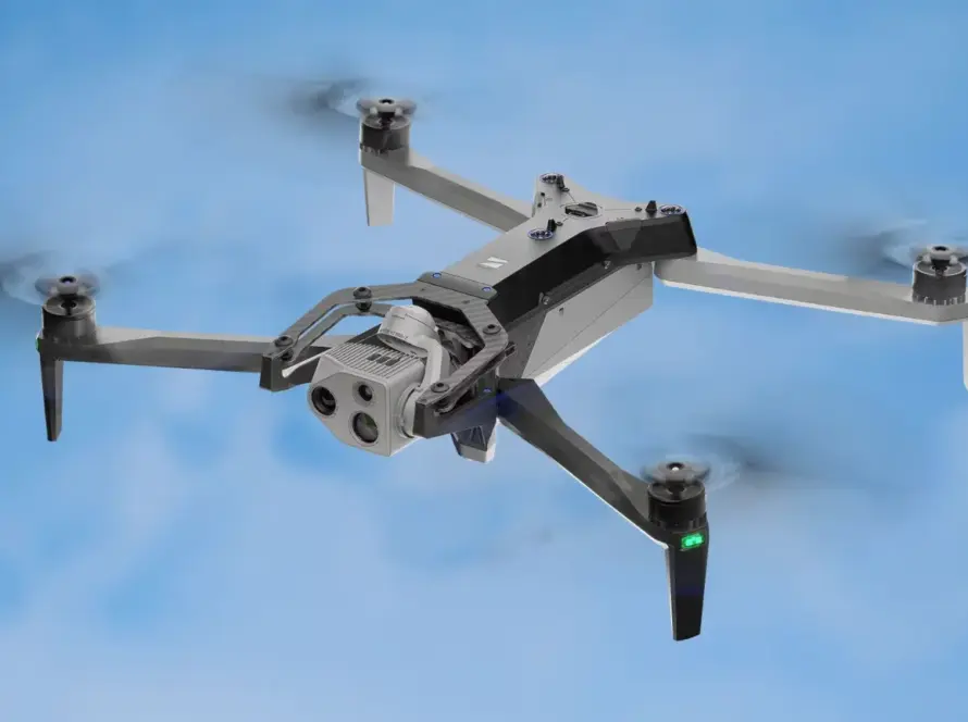
The Autel EVO Max 4T tactical drone represents a significant leap forward in rapid-deployment aerial technology, designed specifically for industrial inspections, search and rescue, and tactical operations. Equipped with advanced AI recognition software and a versatile multi-sensor payload, this platform thrives in complex environments where GPS is unavailable or electronic interference is present. For enterprise operators, the EVO Max 4T delivers industrial-grade reliability under the most demanding conditions.
Quick Summary & Direct Answer
The Autel EVO Max 4T tactical drone integrates a thermal camera, a 10x optical zoom lens, a wide-angle camera, and a laser rangefinder into a single payload. Supported by Autel’s A-Mesh networking technology, it allows multi-drone collaboration and real-time data sharing in GPS-denied and jammed environments, making it ideal for critical infrastructure mapping.
A-Mesh Networking: Seamless Multi-Drone Collaboration
One of the most innovative features of the Autel EVO Max 4T is its proprietary A-Mesh networking system. This technology enables multiple drones in the field to establish peer-to-peer connections, extending the communication range and allowing a single operator to manage multiple aircraft simultaneously. If one drone loses signal or experiences interference, the mesh network automatically reroutes the telemetry and video transmission through neighboring drones. This ensures uninterrupted data flow during large-scale industrial surveys and disaster response missions, where continuous coverage is critical.
Advanced AI Payload and Anti-Interference Capabilities
The multi-sensor payload of the EVO Max 4T allows operators to switch seamlessly between high-resolution optical zoom, thermal imaging, and precise laser distance measurements. Its onboard AI engine automatically identifies and tracks objects, such as vehicles or human signatures, even in low-light conditions. Furthermore, the drone features advanced anti-interference modules that shield communication channels against electromagnetic noise and jamming. This level of hardware resilience makes it a highly dependable tool for scanning electrical grids, pipelines, and rugged mountain terrains.
Autel EVO Max 4T Technical Capabilities Comparison
| Performance Feature | Standard Enterprise Drones | Autel EVO Max 4T Platform |
|---|---|---|
| Networking Protocol | Point-to-point controller connection only | Autel A-Mesh multi-drone dynamic mesh networking |
| GPS-Denied Operation | Relies heavily on satellite signals for stability | Visual and radar navigation for full flight control |
| Payload Configuration | Single sensor or swappable camera mounts | Integrated wide, zoom, thermal, and laser rangefinder |
Deploying Tactical Surveying and Security Drones in Jordan
In Jordan, where rugged terrains like Petra and Wadi Rum require durable equipment, the Autel EVO Max 4T offers distinct advantages. Its ability to navigate GPS-denied environments and withstand dusty desert winds makes it suitable for local mapping and border patrol simulations. Loyalty Drones utilizes high-grade platforms like the EVO Max 4T to support public safety operations and large-scale agricultural mapping in the Jordan Valley, ensuring that local enterprises receive precise aerial data despite challenging environmental conditions.
Partner with Loyalty Drones
Optimize your enterprise mapping and tactical operations with the Autel EVO Max 4T. Contact Loyalty Drones today to schedule a demonstration.