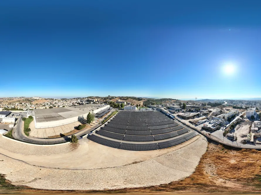
Drone construction progress monitoring captures your site from the same flight path every week, delivering aerial photos, video flythroughs, 3D models and earthwork volumetrics that project managers, contractors and investors can rely on for the truth on the ground. Loyalty Drones runs weekly progress packages across Amman developments, Aqaba bay projects, and government infrastructure in Jordan.
What is in a weekly progress package
- Set of high-resolution aerial photos from 6–10 fixed compass angles.
- 1–2 minute video flythrough showing the site in context.
- Updated orthomosaic for plan-view comparison.
- 3D model with the previous-week mesh overlaid.
- Volumetric report — excavation, fill, stockpile differences.
- PDF dashboard for owner / project director.
Why weekly drone capture beats site walks
| Aspect | Weekly drone capture | Site walk |
|---|---|---|
| Coverage | Whole site, every level | Subset |
| Quantitative | Volumetrics in m³ | Estimate |
| Repeatable | Same path each time | Subjective |
| Time on site | 30 min | 2–4 hours |
| Shareable | One link with owner | Phone photos |
| Dispute resolution | Timestamped truth | He-said/she-said |
Use cases on Jordan construction sites
- High-rise in Amman — façade progress, crane positioning, safety hazards from above.
- Mixed-use developments — Boulevard, Abdoun, Aqaba bay masterplans.
- Infrastructure — road upgrades, water pipelines, rail alignments.
- Industrial — factories in Sahab, Mafraq, Aqaba ASEZ.
- Earthworks contractors — monthly volumetrics for billing reconciliation.
- Disputes — independent weekly snapshots for arbitration.
Cost in Jordan (indicative)
| Package | Frequency | Starting price (JOD/month) |
|---|---|---|
| Basic — photos + video | Weekly | 1,200 |
| Standard — + orthomosaic | Weekly | 2,200 |
| Advanced — + 3D + volumetrics | Weekly | 3,500 |
| Enterprise — + thermal/BIM | Bi-weekly to weekly | 5,000+ |
Deliverables your team can actually use
We export to the formats your engineers and PMs already work with: DWG/DXF for contours, LAS/LAZ point clouds for BIM, IFC for BIM integration, GeoTIFF orthomosaics for GIS, MP4 video for the steering committee. Everything is hosted on a per-project secure web viewer so stakeholders see the same data at the same time.
Permits in Jordan
Construction site overflights still need CARC operator approval and (for restricted areas) project-specific NOTAMs. Loyalty Drones handles the permit pipeline as part of the monthly subscription so the site team never has to manage it.
Why Loyalty Drones
We have the AEC workflow ready: RTK drones, ground-control survey, BIM-ready exports, secure project portal. Related: construction drone services, surveying & mapping and LiDAR mapping.
Frequently Asked Questions
How accurate are the volumetrics?
With surveyed ground control, ±3 % volumetric accuracy on stockpiles and ±5 cm on cut/fill surfaces.
Can we share the deliverable with the owner / consultant?
Yes — a per-project web viewer is part of the package. Access is permissioned per stakeholder.
What happens if weather cancels the weekly flight?
The flight is rescheduled within the same week at no extra cost. Severe weather windows are part of the contract.
Do you integrate with Procore / Autodesk Construction Cloud / BIM 360?
Yes — orthomosaic and 3D mesh layers can be uploaded directly to your common data environment.
Get a Quote From a CARC-Licensed Jordan Drone Team
Loyalty Drones is a CARC-licensed, fully insured Jordan drone operator serving clients from Amman to Aqaba. Contact us for a free quote within 24 hours, or visit our homepage to see recent work.
Related Drone Services in Jordan
Loyalty Drones is the CARC-licensed team behind every page on this site. These are the services most relevant to this article:
Or browse the full service list on the services hub, or read about us on the About page.